Dec 4th,2013
Ruben:
In technologically civilized places, digital subscriber line data flows happily back and forth through cozy copper wires. It meanders from houses and local loops to the loop extender, on to the access multiplexer and arrives at the remote access server without even breaking a sweat, ready to broadcast a person's - or machine's - digital desires to the universe. Such is the magic behind the Internet.
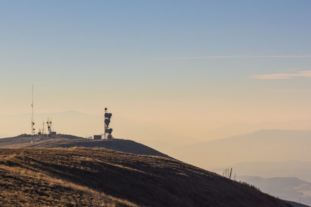
Unlike those pampered city bytes our deep country data seeks adventure. To span the 10 mile air gap between our village and the butte that delineates our south-eastern horizon, our data cycles its energetic state five billion and four hundred million times a second; it liberates itself through an antenna, bounces off a parabolic reflector and flings itself across rivers, valleys, plateaus, and forests at the speed of light to be received by a lonely monument crowning the crest of Stacker Butte, thereby connecting our digital stream of hopes and dreams to the virtual oceans of the world.
A pilgrimage to this sacred place was long overdue. My dad visiting us and wanting to see more of the area was the last excuse I needed to undertake a lovely drive and afternoon hike to this venerable location. My dad and I were joined on this merry adventure by Monica, Pat, and Willie the dog.
The access road and trail to the summit lie on the far side of the butte. Getting to the far side meant driving the twenty miles down to the Columbia River and snaking along its northern bank for another ten miles until we found the windy gravel road leading to the trailhead. From the trailhead it is another ~3 miles by foot to the top of Stacker Butte.
Intermittently bathed in sunlight and chilled by a steady mountain breeze our bodies didn't quite know whether to be hot or cold. After three brisk miles up the hill we were ready for a break.
The panorama that presented itself to us as we arrived at the top took us all by surprise. From the top of Stacker Butte we could see for miles and miles in every direction, including views of Mt Hood, Mt Adams, Mt Rainier, the Simcoe Hills, the Cascades, the Goldendale Plateau, Appleton Plateau, Wahkiacus Plateau, Klickitat River Valley, Bowman Creek Valley, the Columbia Gorge, hundreds of windmills, and of course the lonely steel giants that are forced to enjoy these vistas all year around: our gatekeepers to the Internet.

In the background: alien landscape between Highway 197 and the Deschutes River Valley on the far side of the Columbia.
"10/10, will do again" would be the short summary of this trip. With more words to spare, I want to make the point that the view from Stacker Butte, aside from breath taking, is also a phenomenal education to the nature and character of this region. It offers a comprehensive visual overview of the different geographical, ecological, and economical constituents of our homeland, a view that makes it abundantly clear: we who live here are all wealthy in ways that words struggle to convey.


